⚠❄WINTER STORM WATCH Wednesday into Thursday. Moderate to heavy snow is possible. ⚠❄
…Moderate to Heavy Snow Possible Wednesday Afternoon through Thursday Morning…
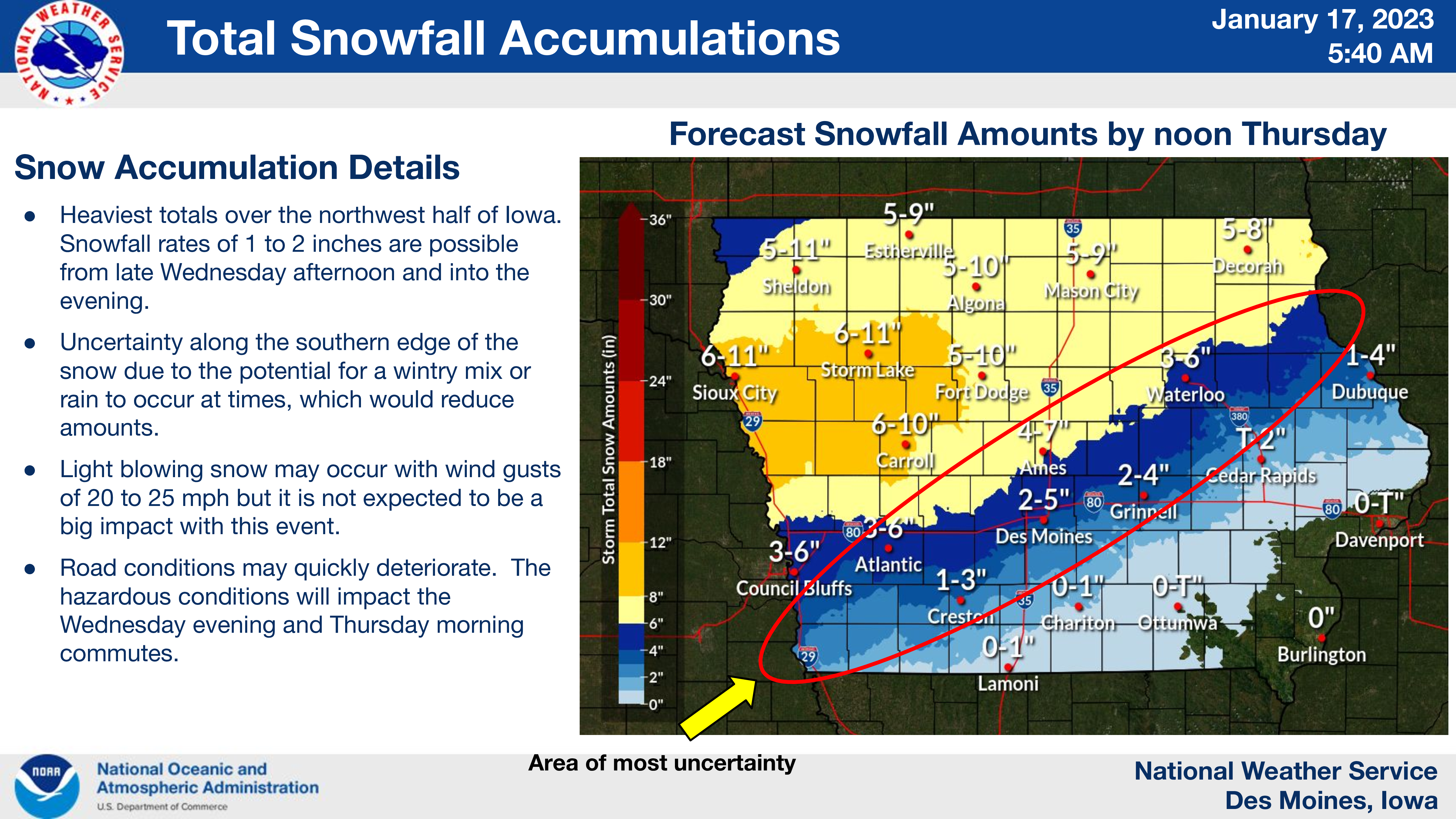
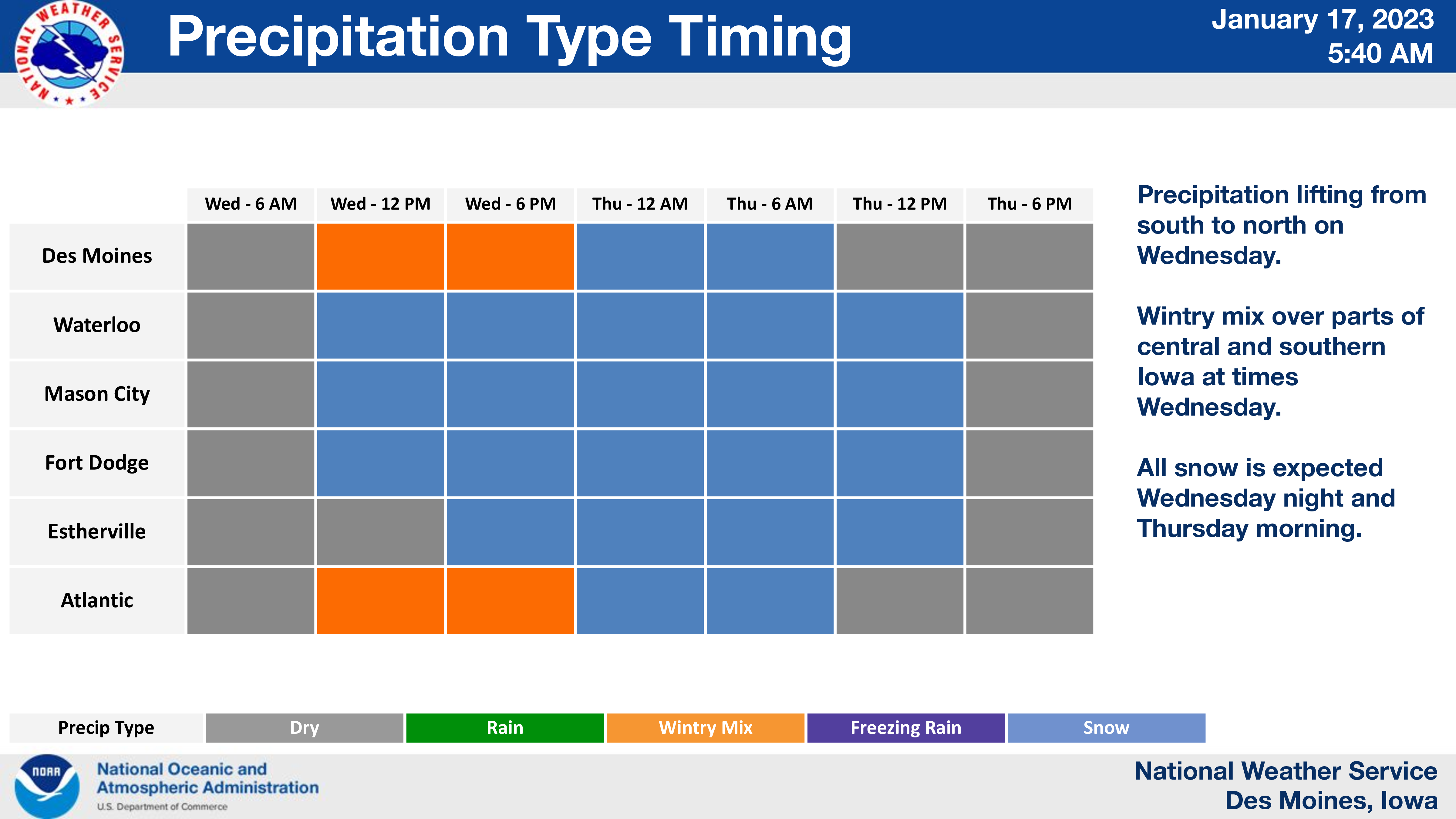
Snow will spread north across much of central and northern Iowa by Wednesday afternoon. Snowfall rates may peak at 1 to 2 inches per hour at times during the late afternoon and evening hours Wednesday.
Some minor blowing snow may occur with wind gusts in the 20 to 25 mph range but it is not expected to be a significant impact with this event. The precipitation may be a wintry mix or even rain at times early in the event over parts of central Iowa, mainly south of Interstate 80 and therefore, snowfall amounts are less certain in these areas.
The snow will gradually end from southwest to northeast on Thursday.
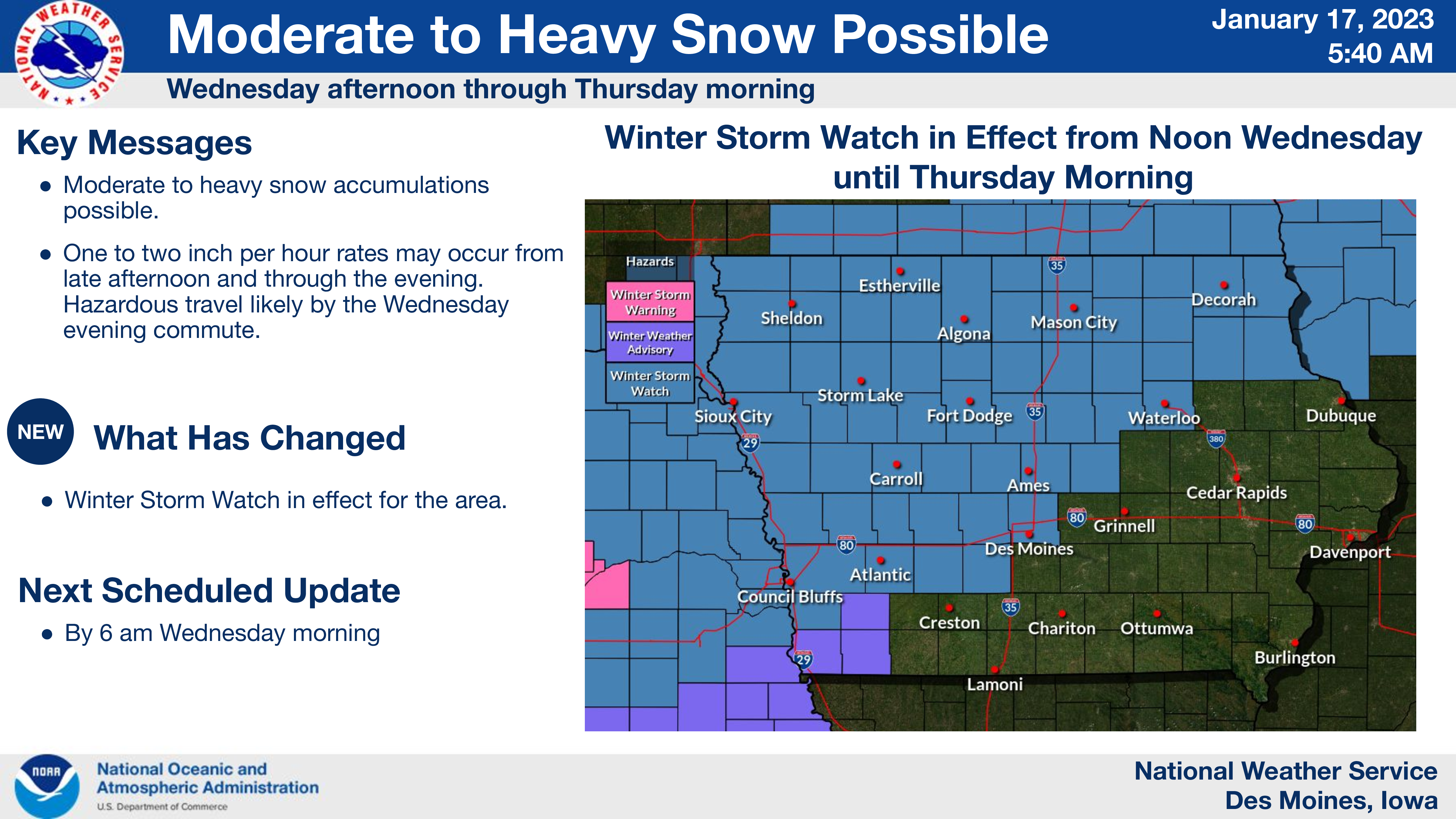
…WINTER STORM WATCH FROM WEDNESDAY AFTERNOON THROUGH THURSDAY MORNING FOR CERRO GORDO, WORTH, WINNEBAGO, HANCOCK, WRIGHT, KOSSUTH, FRANKLIN AND BUTLER COUNTIES…
Moderate to heavy snow possible. Total snow accumulations of 4 to 9 inches with the greatest amounts along and north of a Waterloo to Ames to Atlantic line. Minor ice accumulations are possible over the far south edge of the watch..
…WINTER STORM WATCH FROM WEDNESDAY EVENING THROUGH THURSDAY AFTERNOON FOR FLOYD, MITCHELL AND MOWER MN…
Heavy snow is possible. Total snow accumulations of 5 to 8 inches possible.
…WINTER STORM WATCH FROM WEDNESDAY EVENING THROUGH THURSDAY AFTERNOON FOR FREEBORN AND FARIBAULT COUNTIES IN SOUTHERN MINNESOTA…
Heavy snow is possible. Total snow accumulations of 5 to 8 inches possible.