⛈ Fast Moving Severe Thunderstorms Followed By Light Snow In Far Northern Iowa ❄
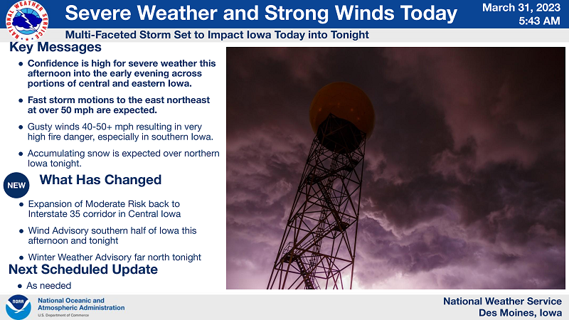
***SEVERE THUNDERSTORMS LIKELY TODAY, THEN SNOW LIKELY OVER FAR NORTHERN IOWA LATE THIS EVENING INTO EARLY SATURDAY***
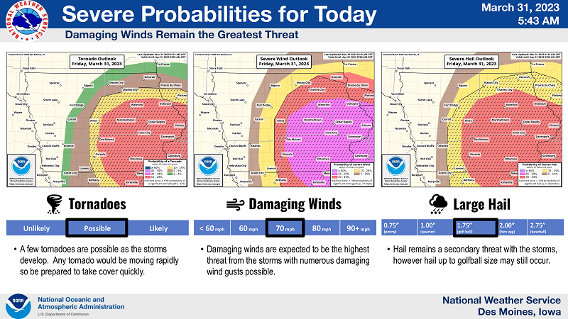
As storms develop after midday Friday, mostly likely east of I-35, they will strengthen quickly and be capable of damaging wind gusts over 70 mph and a few tornadoes. Hail up to 1.5 inches in diameter (ping pong size) may also occur with these storms. These storms will also be moving fast at or over 50 mph, which will lessen the time you have to seek shelter if a storm nears your location.
Know NOW where you will seek shelter on Friday. Winds throughout Friday will be from the south and gusty, but after the “all-clear” from storms in central Iowa in the early evening hours, winds will become from the west and become even stronger.
Thunderstorms are expected to develop Friday early in the afternoon and then move quickly eastward. Here is a rough idea of when the strongest storms may be passing through your area Friday.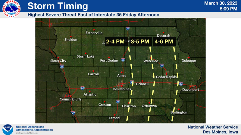
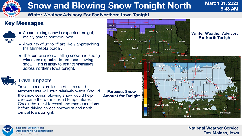
…WINTER WEATHER ADVISORY IN EFFECT FROM 11 PM THIS EVENING TO 7 AM CDT SATURDAY FOR WORTH, WINNEBAGO AND KOSSUTH COUNTIES…
* WHAT…Snow expected. Total snow accumulations 1 to 3 inches. Winds gusting as high as 55 mph will produce
considerable blowing snow with very low visibilities from time to time.
* WHERE…Far north central Iowa.
* WHEN…From 11 PM this evening to 7 AM CDT Saturday.
* IMPACTS…Plan on slippery road conditions. Blowing snow could significantly reduce visibility. Gusty winds could bring down tree branches.
* ADDITIONAL DETAILS…Visibilities in rural areas may be below one quarter of a mile at times with blowing and falling snow.
PRECAUTIONARY/PREPAREDNESS ACTIONS…
Slow down and use caution while traveling.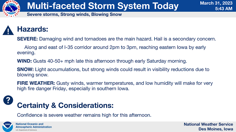
NWS Des Moines


