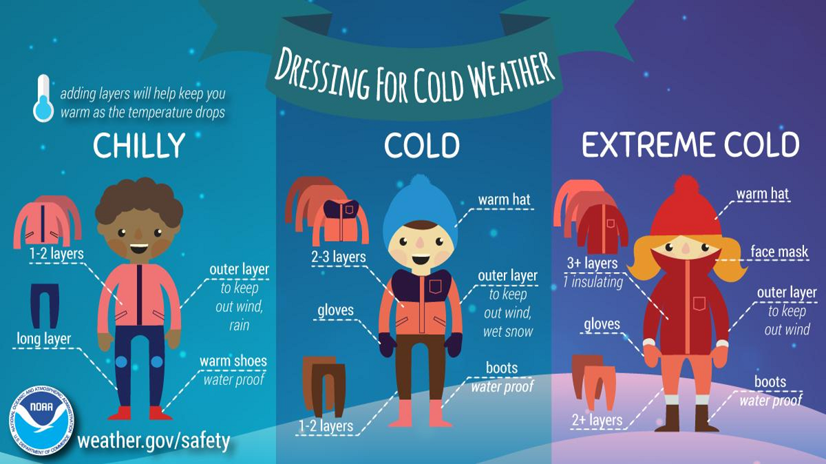
❄ A Winter Weather Advisory is in effect Saturday for portions of northern Iowa.
…Area of Moderate to Heavy Snowfall Overnight Friday into Saturday…
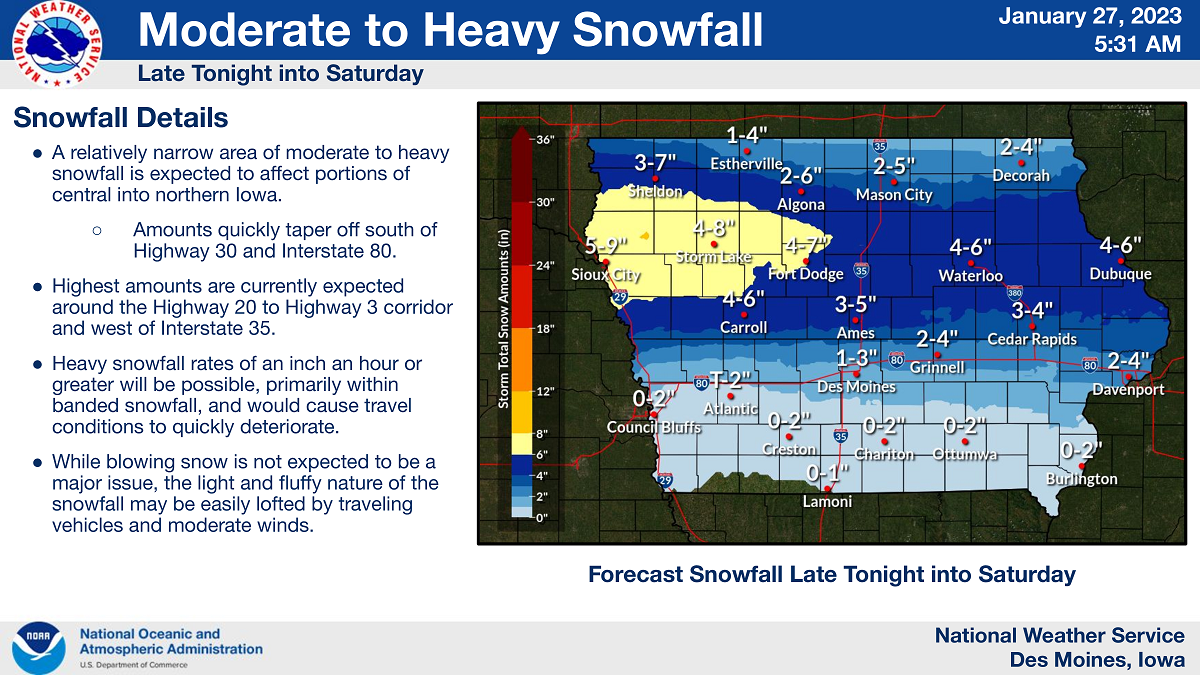
A relatively narrow area of moderate to heavy snowfall is expected to develop Friday night into Saturday over portions of central into northern Iowa. Snowfall will spread in from the west overnight Friday, expanding eastward.
Heaviest snowfall is expected to fall in an east west oriented band around the Highway 20 to Highway 3 corridors, where amounts of 5 to 7 inches or greater will be possible, especially west of Interstate 35.
Heavy snowfall rates of an inch an hour or greater is likely within the heaviest banding. Snowfall will then exit eastward Saturday afternoon and evening.
It remains possible for the axis of heaviest snowfall to shift outside of the Highway 20 to Highway 3 corridors. Monitor forecast updates for any possible shifts.
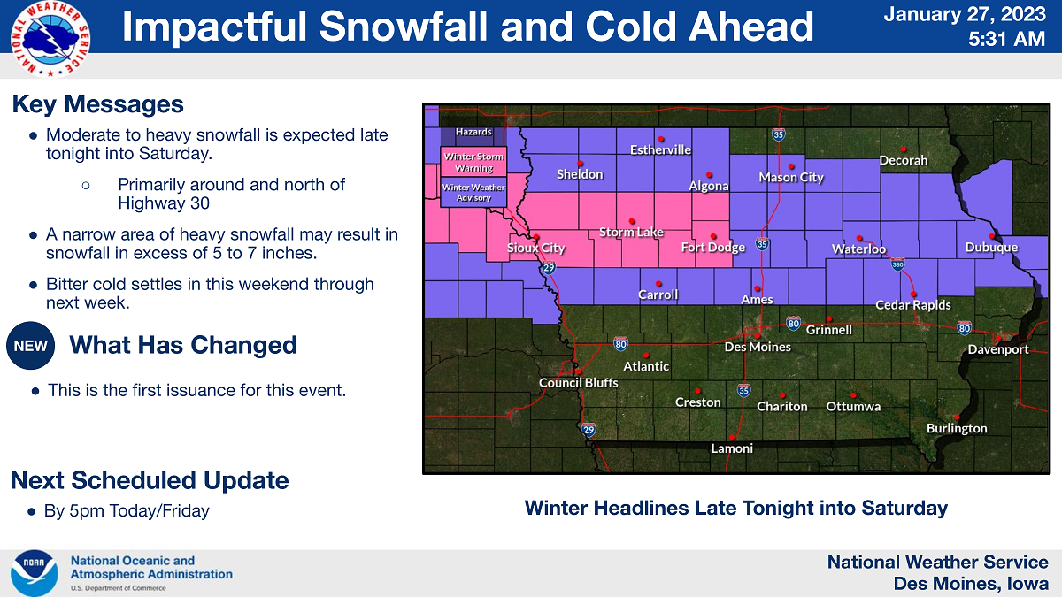
…WINTER WEATHER ADVISORY FROM MIDNIGHT TO 9 PM SATURDAY FOR CERRO GORDO, HANCOCK, KOSSUTH, WRIGHT, FRANKLIN AND BUTLER COUNTIES…
Snow is expected. Total snow accumulations of 3 to 5 inches.
…WINTER WEATHER ADVISORY FROM 3 AM TO 9 PM SATURDAY FOR FLOYD COUNTY…
Snow is expected. Total snow accumulations of 3 to 5 inches.