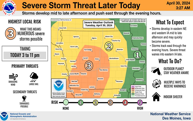
Severe Weather Possible Today and Thursday

Summer-like conditions persist today into Thursday with highs in the upper 80s to lower 90s across all of central Iowa.
There is the threat for storms over west central to northwest Iowa mid afternoon into the evening with a few severe storms possible. The main threat will be from large hail and a tornado or two.
Additional storms are expected on Thursday night with damaging winds the main concern. Cooler temperatures return by Friday as a cold front pushes into the state.
Severe weather threat time frame is from 3 PM to 8 PM today and after 9 PM on Thursday.